
Ours is a neighborhood of schools, houses of worship and small residential buildings. People live here and the place is a nexus of educational activities drawing small children of all ages along with their parents. In addition to the school kids we have a local network of bike routes which in most cases take the form of shared roadways. Parents use these bike routes to ride their small children to school on the backs of electric assist bicycles purchased specifically for this purpose.

For these reasons many of our local streets are severely restricted to rates of speed below that which is observed city wide. While some of our streets do allow traffic to cruise at up to 25 MPH (approx 35 feet per second) legally some are posted with signs telling motorists to slow down to 15 MPH (approx 22 feet per second). These streets are clearly posted but do drivers pay heed to those restrictions? No is the short answer.

To get a sense of how fast folks are driving locally I borrowed a speed gun from the activists at SFMTrA and took several hundred readings at various times of the day and evening surveying the rate of speed on my local streets. Here’s what I found.
Let’s start with an easy street, 17th between Church and Dolores. That’s a 25 MPH city street with a class II bike lane on both sides protecting the parked cars from moving traffic. We took 15 readings of cars moving fairly fast headed West and 17 readings of cars moving fairly quick headed East. These are the averages of those readings.
Where Westbound Eastbound When
17th (Church/Dolores) 31.5 MPH (15) 28.8 MPH (17) Weds 2/1/17 3:52-4:14 PM
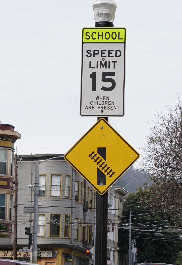
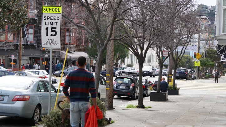
Now let’s move on to 17th Street between Church & Sanchez Streets. That entire block is bounded on one side by two large public schools: Sanchez Elementary School and Everett Middle School. This means the block is posted on both approaches with warning signs telling motorists that they are entering a school zone as well as speed limit restriction signs alerting motorists of the 15 MPH speed limit on that block during school hours.

Actual Speed Survey Data – 17th St.
Where Westbound Eastbound When
17th (Church/Sanchez) 26.2 MPH (17) 27.9 MPH (17) Tues 1/31/17 8:00-8:15AM
17th (Church/Sanchez) 26.5 MPH (14) 28.1 MPH (10) Thrs 1/26/17 10:35-10:50AM
17th (Church/Sanchez) 27.3 MPH (13) 27.1 MPH (15) Mon 1/30/17 10:45-10:53AM
17th (Church/Sanchez) 27.1 MPH (17) 27.7 MPH (15) Mon 1/30/17 5:45-6:15PM
17th (Church/Sanchez) 30.3 MPH (15) 28.9 MPH (14) Weds 2/1/17 9:40-10:15PM
Where Westbound Eastbound When
17th (Sanchez/Noe) 29.5 MPH (17) 28.3 MPH (15) Weds 2/1/17 1:06-1:40PM
17th (Sanchez/Noe) 29.1 MPH (15) 29.5 MPH (15) Thrs 2/2/17 4:00-4:20PM
As we can see from the data above, motorists are completely ignoring the school zone speed restrictions in favor of maintaining a pace of between 25 and 30 miles per hour through this area. This higher than optimal speed increases the danger to a second group of road users, the bike riders on City Bike Route 40 (AKA 17th Street).
17th Street between Church and Sanchez is a completely unmarked section of City Bike Route 40, a critical link from the Castro to The San Francisco Bay. While most of this route is a class II bike path the shoofly tracks which SFMTA has been opportunistically using to increase the level of service for cars on Market Street have the disadvantage of making bike path or shared lane markings impossible due to the geography of the road space.

This means that several hundred bicyclists per day are having to maneuver over those extremely dangerous Light Rail Vehicle rails with five inch flange ways with no signage whatsoever to let drivers know that this is supposed to be a shared roadway. Note that these cars are going approximately twice the speed of the average bike rider in this 600 foot long “shared roadway.” (Click here for a look at how that works out in real life.)
Just for good measure you can see that I threw in some data from 17th Street between Sanchez and Noe Streets to continue in that general direction. We can see the pattern. For the record though, that stretch is a normal street and 25 is considered legal. But also of note is the fact that the downhill side of that street gets a lot of bike crashes historically speaking. The speed of the riders plus the tracks and everything else seems to be a bad combination.
And, as with the next block in each direction, this stretch of 17th has no indication of it’s shared lane status so bikes are on the bike route but with no infrastructure to make cars aware of this fact.
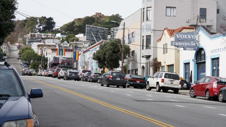
Now let us turn our focus to San Francisco Bicycle route 47 (aka Sanchez Street) from 17th Street to 16th Street. This one block fronts Sanchez Elementary School, features Eisenhower era front first perpendicular parking and is a shared roadway in both directions. 
California Vehicle Code – VEH — DIVISION 11. RULES OF THE ROAD [21000 – 23336] CHAPTER 1. Obedience to and Effect of Traffic Laws [21000 – 21296]
ARTICLE 4. Operation of Bicycles [21200 – 21213]
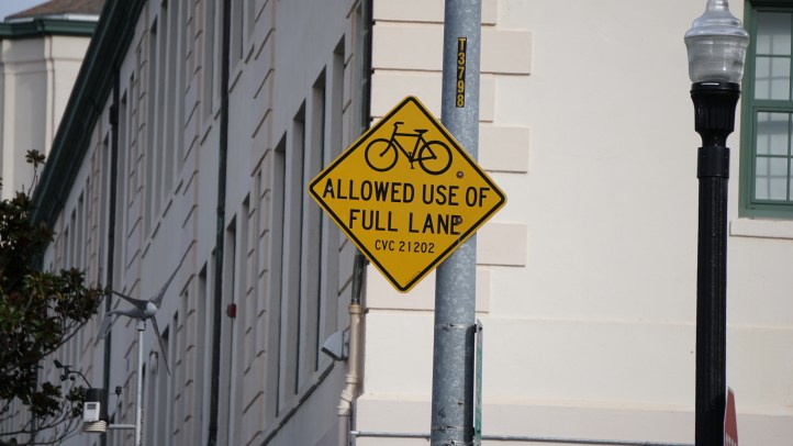
21202. (a) Any person operating a bicycle upon a roadway at a speed less than the normal speed of traffic moving in the same direction at that time shall ride as close as practicable to the right-hand curb or edge of the roadway except under any of the following situations:
(1) When overtaking and passing another bicycle or vehicle proceeding in the same direction.
(2) When preparing for a left turn at an intersection or into a private road or driveway.
(3) When reasonably necessary to avoid conditions (including, but not limited to, fixed or moving objects, vehicles, bicycles, pedestrians, animals, surface hazards, or substandard width lanes) that make it unsafe to continue along the right-hand curb or edge, subject to the provisions of Section 21656. For purposes of this section, a “substandard width lane” is a lane that is too narrow for a bicycle and a vehicle to travel safely side by side within the lane.
(4) When approaching a place where a right turn is authorized.
(b) Any person operating a bicycle upon a roadway of a highway, which highway carries traffic in one direction only and has two or more marked traffic lanes, may ride as near the left-hand curb or edge of that roadway as practicable.

Actual Speed Survey Data – Sanchez St.
Where Northbound Southbound When
Sanchez (16th/17th) 27.8 MPH (15) 26.2 MPH 16) Weds 2/1/17 8:10-8:48 AM
Sanchez (16th/17th) 27.2 MPH (18) 25.6 MPH (15) Tues 1/31/17 8:30-9:05 AM
Sanchez (16th/17th) 27.6 MPH (14) 25.5 MPH (15) Mon 1/30/17 10:55-11:05 AM
Sanchez (16th/17th) 28.4 MPH (16) 26.4 MPH (15) Thurs 2/2/17 3:20-3:50 PM
Sanchez (16th/17th) 27.6 MPH (15) 27.7 MPH (15) Tues 1/31/17 5:40-6:12 PM
Sanchez (16th/17th) 27.9 MPH (15) 28.0 MPH (17) Thurs 2/2/17 8:45-9:15 PM
& Church Street:
Church (16th/17th) 27.7 MPH (16) 25.5 MPH (15) Mon 1/30/17 12:00-12:15PM
Church (16th/17th) 28.3 MPH (15) 26.5 MPH (15) Weds 2/1/17 3:09-3:47PM
As the data clearly displays, there is no difference from Church Street on the other side of the same block for rate of speed data despite different speed limits and postings on the two streets. One more observed characteristic of Sanchez Street is the large and increasing volume of vehicles using that relatively small street. We conducted three informal vehicle counts on Sanchez Street to understand this aspect better.
Vehicle counts on Sanchez Street
Thursday, February 9, 2017 from 7:31 – 8:31 (AM): Northbound Cars: 263 – Northbound Bikes: 6 (2% bikes) — Southbound Cars: 210 – Southbound Bikes: 10 (4% bikes) [489 total vehicles]
Thursday, February 9, 2017 from 12:00 – 1:00 (PM): Northbound Cars: 164 – Northbound Bikes: 5 (3% bikes) — Southbound Cars: 151 – Southbound Bikes: 7 (4% bikes) [327 total vehicles]
Thursday, February 9, 2017 from 5:53 – 6:53 (PM): Northbound Cars: 199 – Northbound Bikes: 18 (8% bikes) — Southbound Cars: 226 – Southbound Bikes: 9 (4% bikes) [452 total vehicles]
So now we see why so few bikes want to attempt this street. The geometry is against them and the cars are dominating the street cruising virtually non stop at twice the rate of speed a bike is capable of. (This lack of riders explains the low accident numbers on the street. In a bizarre twist, SFMTA points to those low casualty numbers as proof that the street is safe and thus it doesn’t need reverse angle parking or other safety upgrades.)
To ride on Sanchez Street bicyclists must assert their rights by diving in between moving vehicles and trying to hold their place while several 4,000 pound cars attempt to pass them on this dangerous two way road. At any time a car can blindly back out into their path because of the front first perpendicular parking along the street’s Eastern curb face or stop suddenly in front of them to pull into one of these parking stalls from either side of the road.
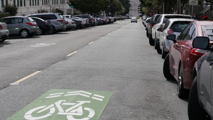
While there are signs saying “Share the road” and there are sharrows at each end of the road there are no sharrow markings in the center of the street despite the California Manual on Uniform Traffic Control Devices specifically saying that shared lane markings should be installed every 250 feet on such a roadway.
Just for good measure we took some readings on several blocks of 16th Street to round off our block data and we ran over to Market Street where that guy was killed crossing the street between Safeway and Whole Foods just to see how fast folks are driving.

Additional local Rate of Speed Data – 16th St.
Where Westbound Eastbound When
16th (Church/Sanchez) 29.5 MPH (15) 22.8 MPH (15) Mon 1/30/17 11:37-11:58 AM
16th (Sanchez/Noe) 27.7 MPH (13) 22.5 MPH (15) Mon 1/30/17 11:20-11:34 AM
& Market St.
Market (Church/Dolores) 30.4 MPH (16) 33.5 MPH (18) Mon 1/30/17 9:26-10:05 PM
We note the Eastbound lane on 16th Street slows down considerably compared to everything around it. Why do you suppose this is? It is a factor of lane dimensions. That is a single lane and is bounded by parking and oncoming traffic such that it’s width is severely limited and so drivers respond by slowing down. This is an excellent example of traffic calming.
The higher speeds common on Westbound 16th Street are especially concerting due to the fact that there is a not buffered very narrow bike lane slipped in between highly active traffic lanes on 16th between Sanchez and Noe. This would probably cause more accidents if anyone was brave enough to use it.

